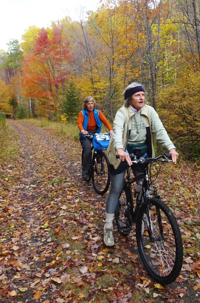
The Friends of the Presidential Rail Trail have joined together to promote, protect, and maintain New Hampshire’s Presidential Rail Trail between Gorham and Whitefield for non-motorized recreation during the snow-free times of the year.
– Come travel the trail on foot or by bicycle
– Look for birds, bears, moose, turkeys and wild flowers
– Hunt and fish in season
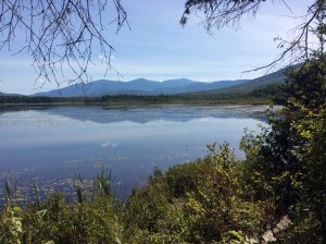
– Enjoy the views of the mountains and marshes
Recent News
Recent News
PRESIDENTIAL RAIL TRAIL: 2020 REPORT
The scenic Presidential Rail Trail, like many rail trails around the country, is experiencing a dramatic increase in users, including cyclists, walkers, runners, cross-country skiers, naturalists, fishermen, equestrians, dog teams, and even llamas. Our public Facebook group, FriendsofthePresidentialRailTrail, has more than doubled its membership in the last four years, and in late June 2021 numbered more than 750 individuals.

The Cross New Hampshire Adventure Trail. The most important development for the PRT has been the founding in 2017 of the Cross New Hampshire Adventure Trail that runs between Woodsville and Bethel, Maine, traversing two sections of our rail trail. xNHAT’s energetic and visionary creator Marianne Borowski described the route as “a continuation of the Cross Vermont Trail in style and spirit: a combination of rail trails, back roads, dirt roads, and paved roadways.” Its website xNHAT includes an excellent interactive map. A packet of printed information is available. There is lots of information on local businesses and advice on planning a trip; points of interest, like historic bridges, are described in detail. Those who complete the full journey across the state can acquire an attractive embroidered patch.
The xNHAT has brought increased media attention to the PRT, including Rails-to-Trails ranking as the top rail trail in New Hampshire. A 2021 article in Yankee magazine describes a cyclist’s journey in vivid detail. In the last few years many of our Facebook group’s members have posted wonderful photos and comments at all seasons.
Ms. Borowski has not only publicized the PRT but has helped finance improvements to the trail, like the installation of five newly invented devices called “beaver deceivers” that keep beaver activity from flooding the trail. The installation of beaver deceivers mitigates damage by beavers yet allows them to continue living and acting like beavers, enhancing the landscape and providing entertainment for homo sapiens. In May 2021 she arranged the installation of a Portapotty near Randolph’s municipal building on the Pinkham B (Dolly Copp) road. Her organization is funding its installation and maintenance.
Ms. Borowski has not only publicized the PRT but has helped finance improvements to the trail, like the installation of five newly invented devices called “beaver deceivers” that keep beaver activity from flooding the trail. The installation of beaver deceivers mitigates damage by beavers yet allows them to continue living and acting like beavers, enhancing the landscape and providing entertainment for homo sapiens. In May 2021 she arranged the installation of a Portapotty near Randolph’s municipal building on the Pinkham B (Dolly Copp) road. Her organization is funding its installation and maintenance.
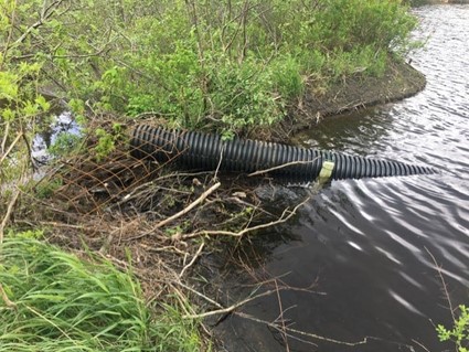
Improvements to the PRT. Substantial progress was made in 2020. NH’s Bureau of Trails (BOT) repaired bridges and worked on the trail surface in the spring. In early April an extensive washout destroyed a major beaver dam to the east of the Pinkham B Road in Randolph, and the deluge gutted the trail. BOT wasted no time bringing in the needed machinery and manpower by mid-April to restore the trail. A beaver deceiver has been installed at this site.
An intense rainstorm on July 14th wreaked havoc around the region, washing out a bridge on the Moose River that forced the official closure of the trail near Gorham. A temporary fix allowed determined cyclists to carry their bikes across the gap. BOT soon moved heavy equipment to the site, reinstalling a small bridge and reopening the trail.

In September 2020 BOT completed extensive PRT improvement in the Pondicherry section, redoing 4 miles: ditchline and resurfacing of all 4 miles; 12 culverts replaced; 4 beaver deceivers installed; total expenditure of $105,000. A grant from the Federal Lands Access Program (FLAP) was secured by our member David Govatski that was matched by a 20% grant from the US Fish & Wildlife Service. The final product has greatly improved the trail’s surface. Our steering committee is hoping to obtain funding for other segments of the PRT.

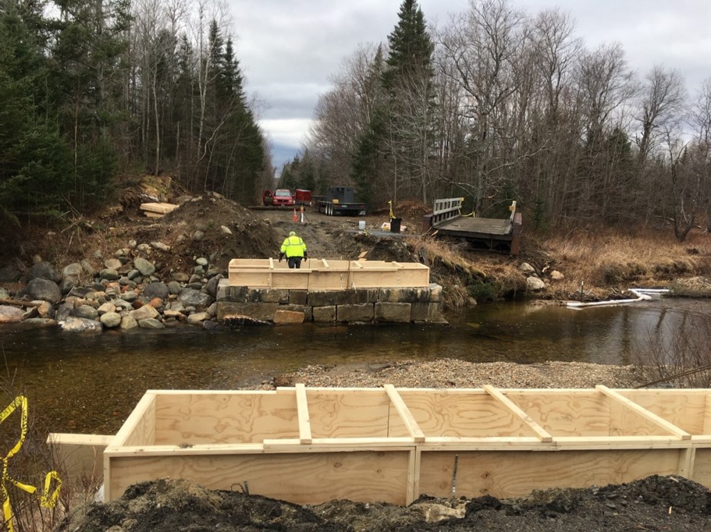
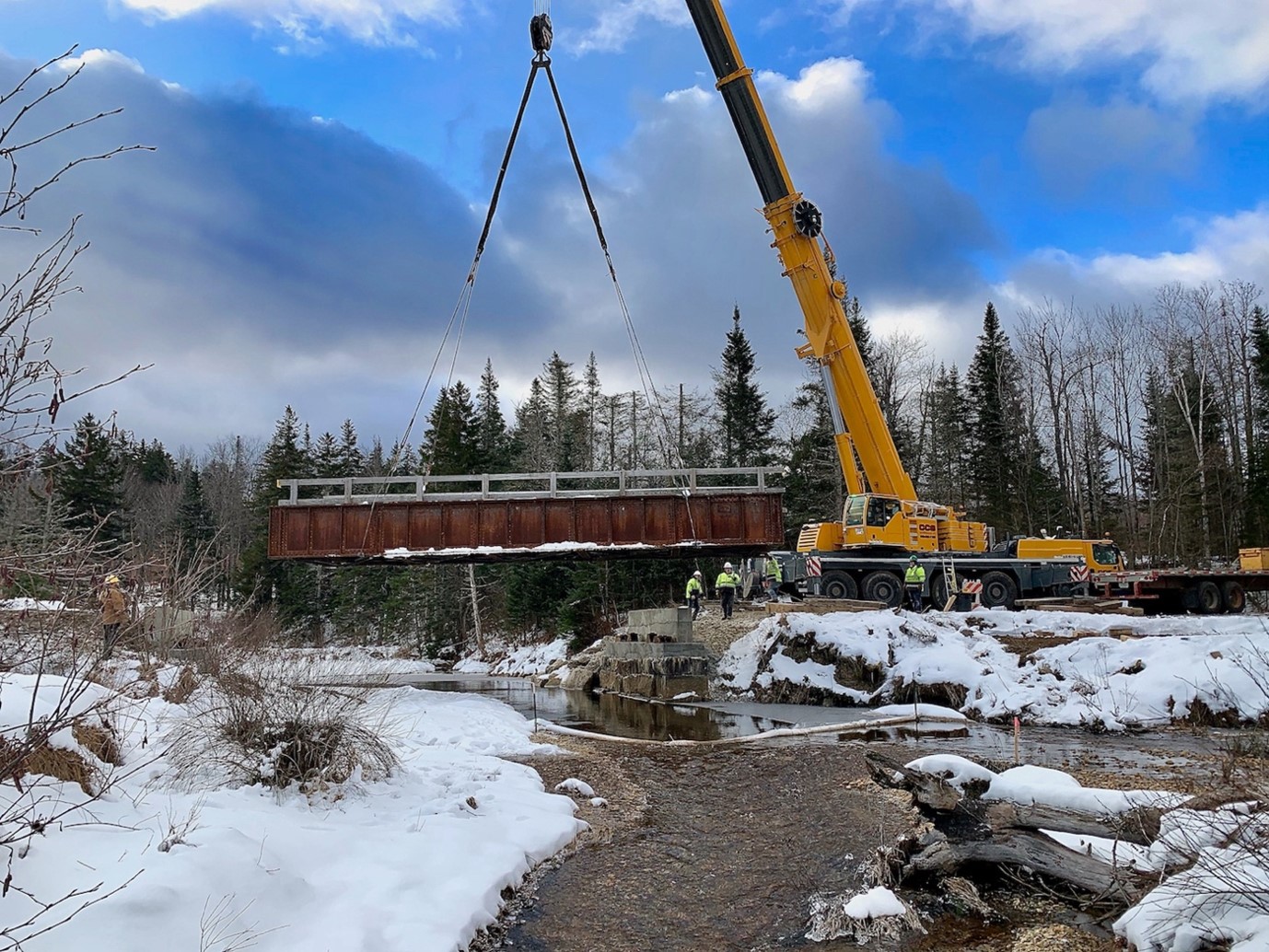
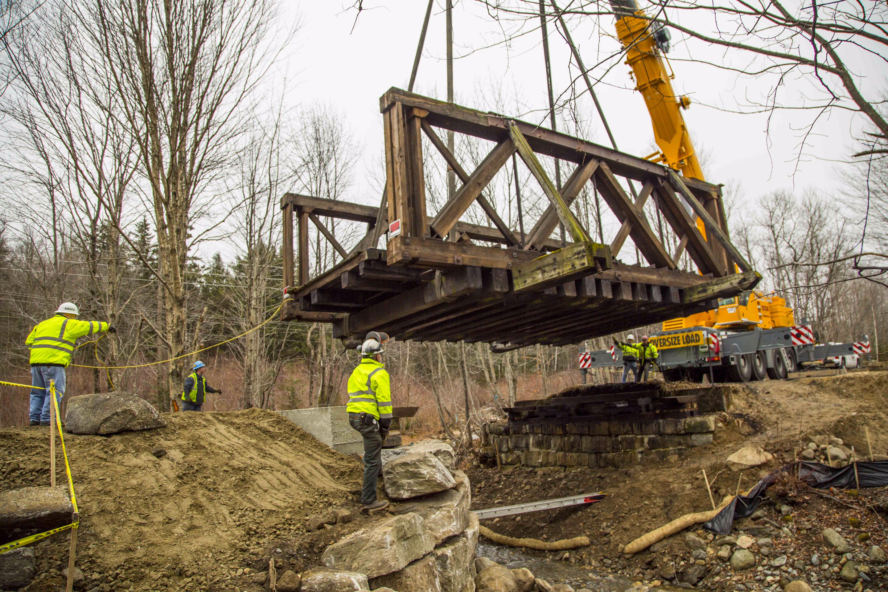
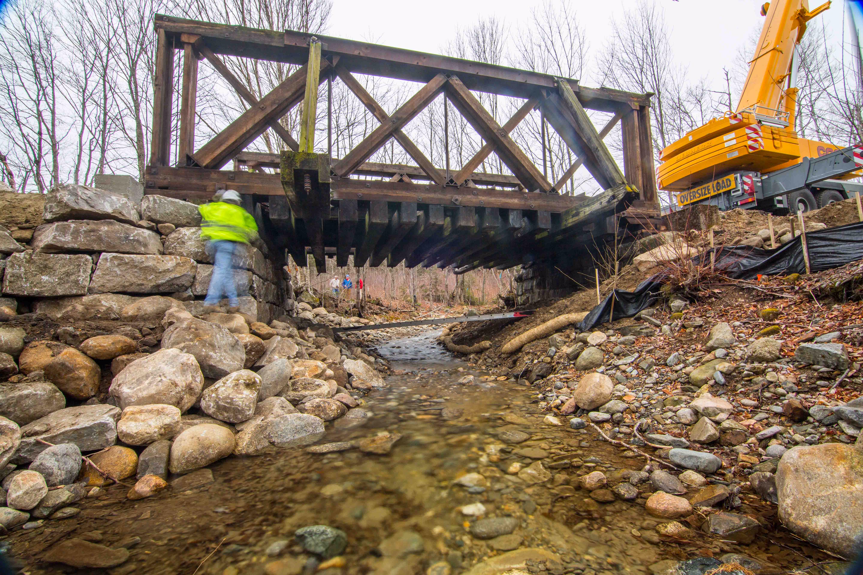
In November 2020, Dennis Thompson (of New England Field Services of Stewartstown) was hired by BOT to repair the decaying abutments beneath the Israel River bridge in west Randolph. It was quite a sight to watch an enormous crane lift the 65,000-pound iron bridge off and then, once the repairs were finished, return it back onto its supports. An early November snow added to the challenge of the work.
We are very grateful to BOT’s former director Chris Gamache and Clint Savage for their continuing support. The PRT is an important segment of NH’s snowmobile network in the winter, and much of BOT’s activity is financed by snowmobile licensing. Cross-country skiers, dog sledders, and snowshoers also are allowed winter access. We ask walkers to refrain from using the trail when the snow is soft, as your postholes ruin the trail for other winter users.
Other Activities. The New Hampshire Division of Historical Resources has conducted a study of the historic White Mountain Railroad, documenting various aspects of the original system to which the PRT once belonged. Our steering committee is working to identify spots where we might post signage with historical information.
During the non-motorized seasons, the PRT Friends continue performing various tasks: picking up trash, mowing, and removing blowdowns that have fallen across the trail. If you encounter downed trees on the trail, you can report them to us with a Facebook post including its location or call BOT directly: 603-271-3255 (Concord main office); 603-788-3155 (Clint Savage in Lancaster). As we meet cyclists and other users, we enjoy answering their questions to help them appreciate the trail. Our major goal is to preserve this extraordinary natural treasure for future generations.
Many thanks to our photographers:
Carol Bourque, Abby Evankow, Bob Holdsworth and Edith Tucker
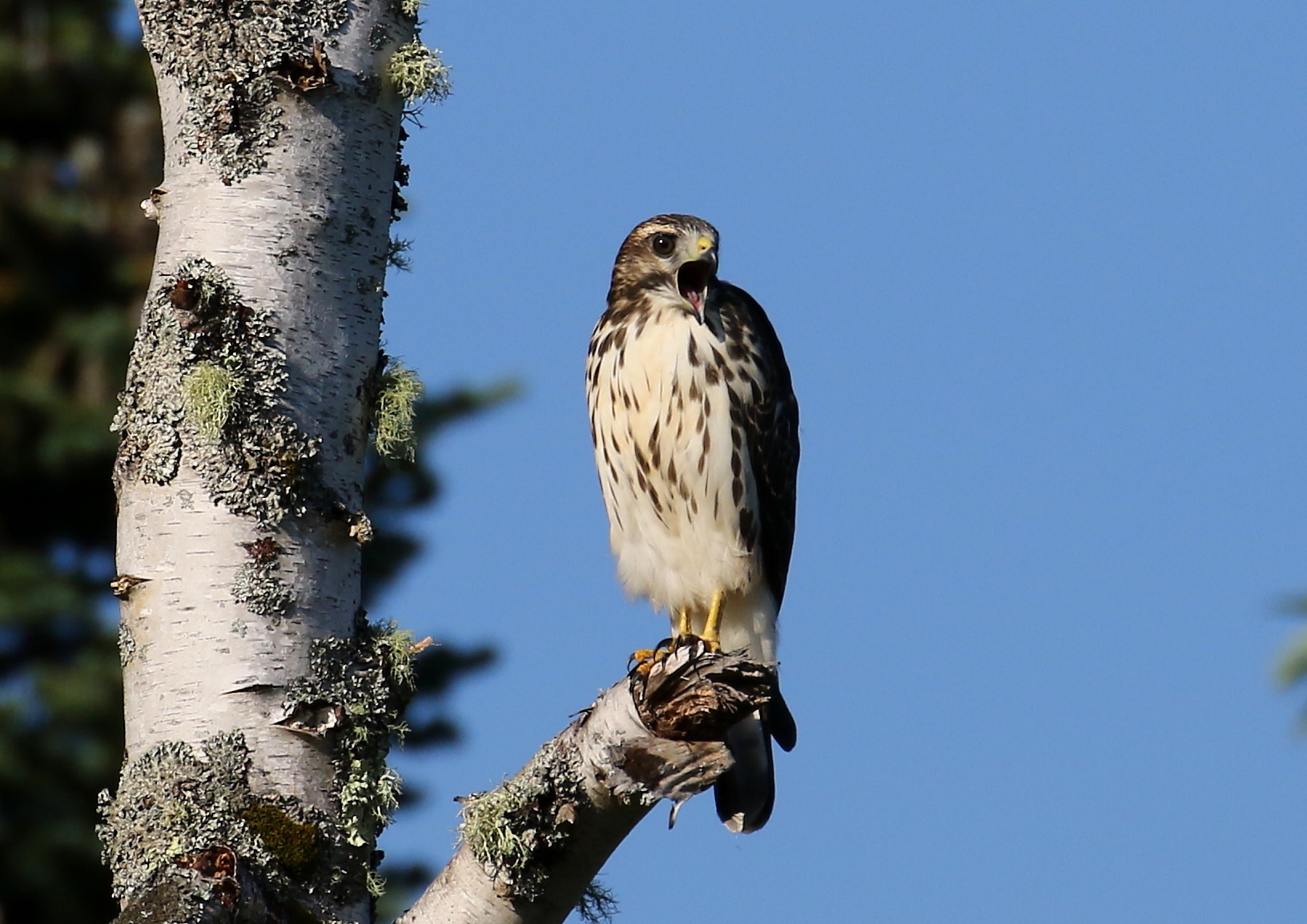
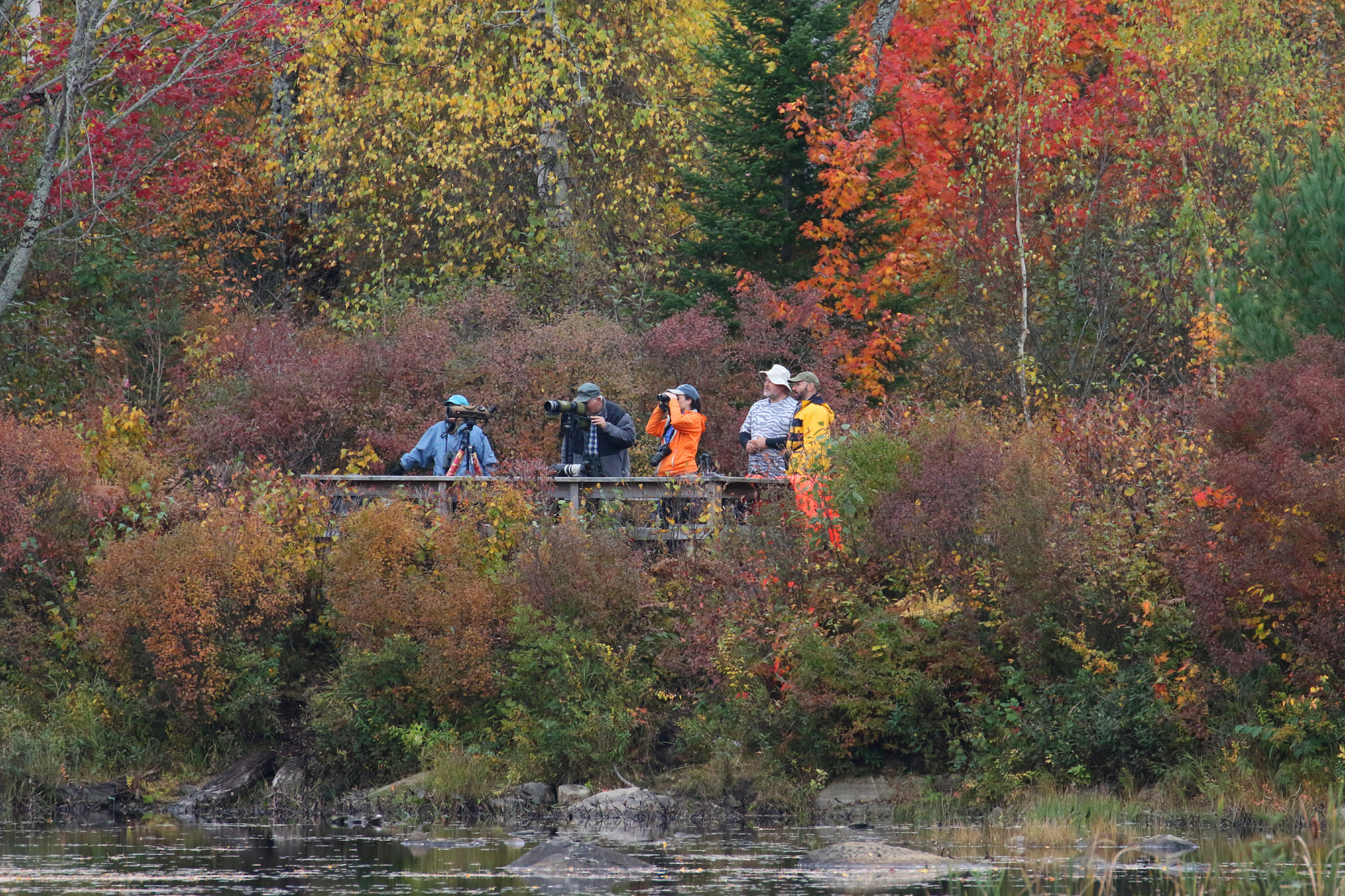
“Hotspots” for Birds on the PRT
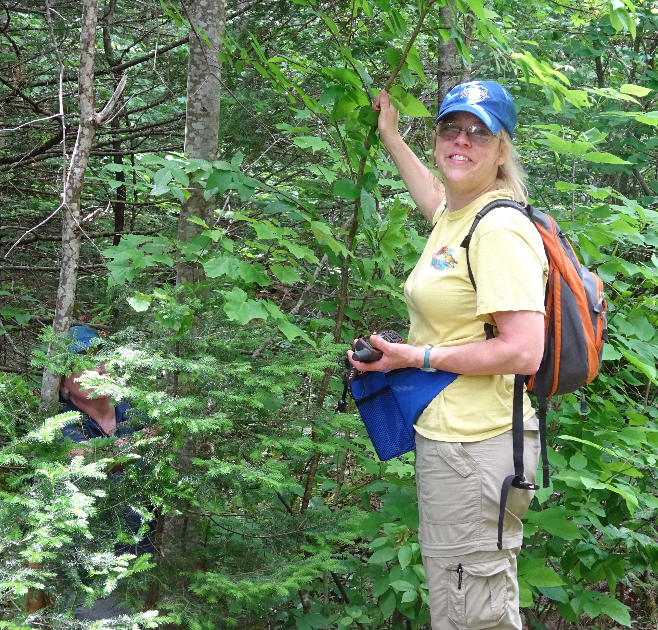
By David Forsyth [All photos by the author]
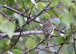
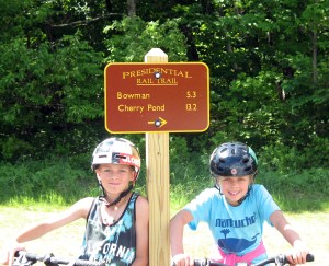
The Presidential Rail Trail stretches for about 20 miles from Gorham to the Airport (Hazen) Road near the Whitefield airport. While you may observe birds anywhere along the trail, there are two main “hotspots” for birding. A couple of others are worth exploring; the Whitefield Airport area itself, which, although strictly speaking not on the trail, is special. One hotspot is in eastern Randolph towards the Gorham end of the rail trail, while the other is at Cherry Pond in the Pondicherry Wildlife Refuge near the western end of the trail. Although many of the birds that you are likely to find are common to both hotspots, the two sites offer quite different birding experiences. The Randolph section of rail trail is an intimate setting, with the birds in close proximity to the trail, whereas near Cherry Pond the open water and wetland areas extend over a much larger area, and the birds are further away. Of course, this larger pond attracts more waterfowl, especially during migration.
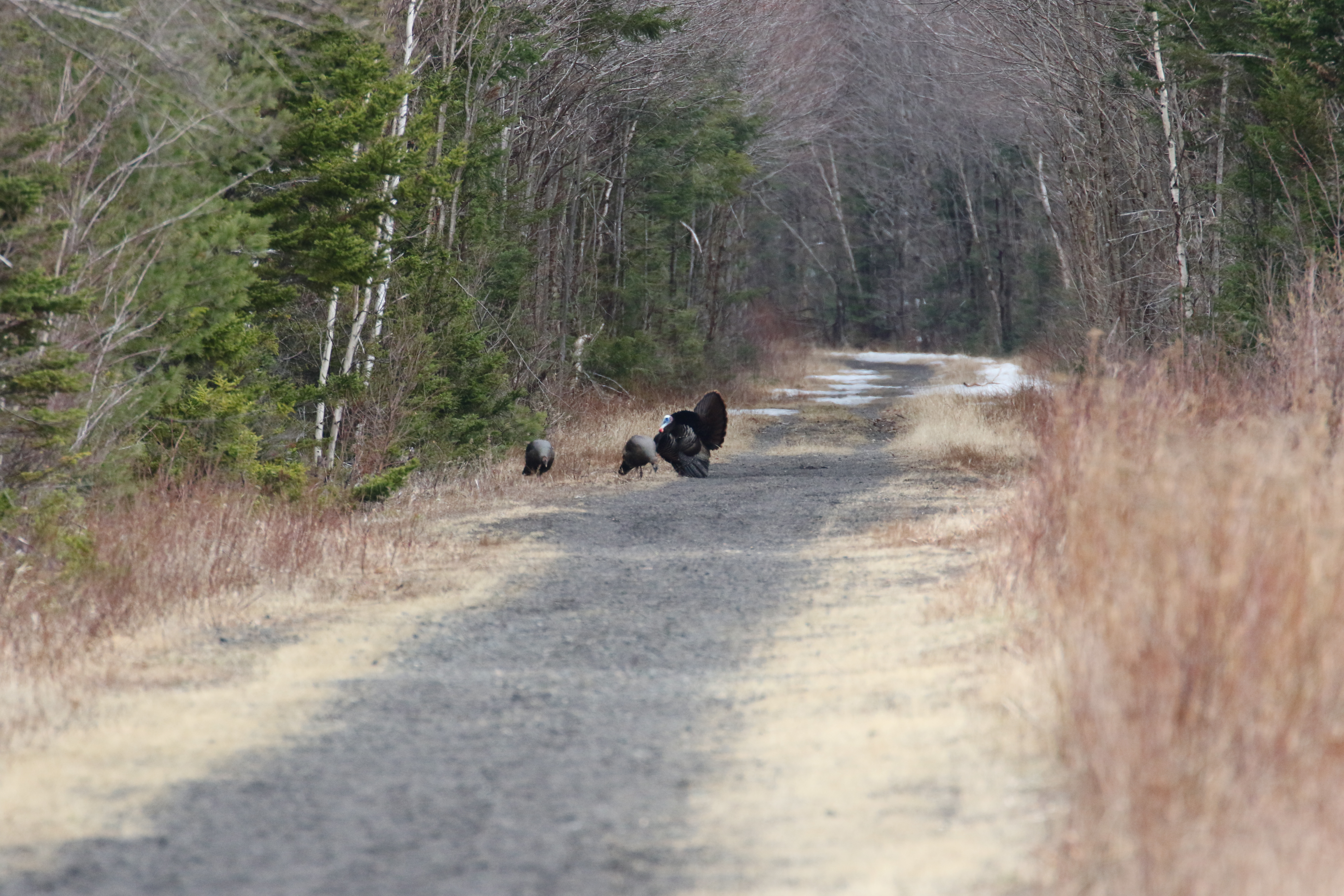
Wild turkeys on the eastern section of the PRT
Beaver Ponds in Randolph
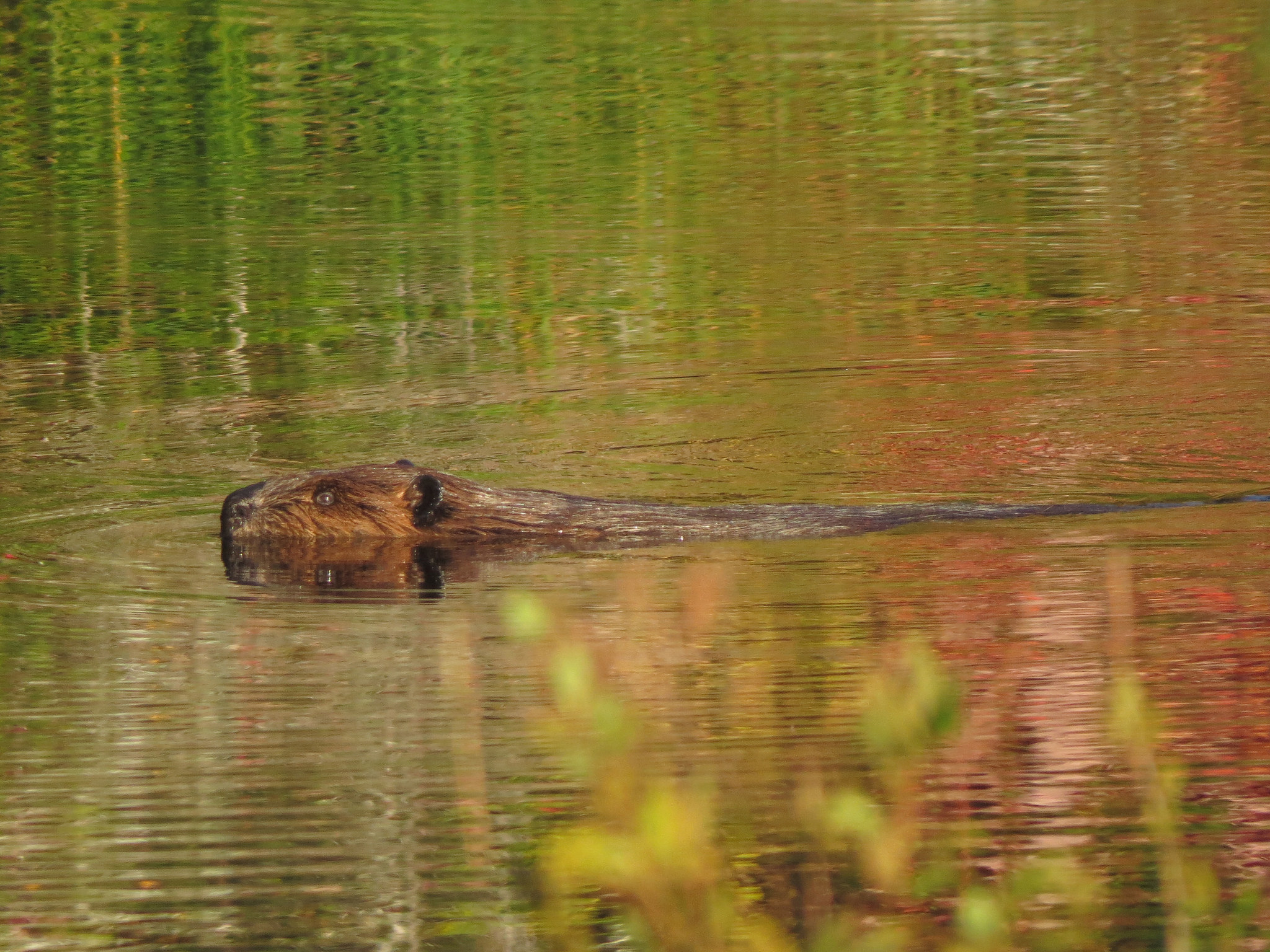
Starting where the PRT intersects the Dolly Copp (Pinkham B) Road in Randolph, a half-mile stretch heading east towards Gorham provides very interesting birding. In the summer I have observed more than 50 species here. The first quarter-mile heads through mostly deciduous, fairly dense woods with a small amount of slowly moving water beside part of it. The next quarter-mile is an open area with beaver ponds and wetlands. Beyond this, the trail runs through mostly coniferous woods at the base of a ridge on Mount Madison. Thus, the habitat varies significantly over a short distance. The open area near the beaver ponds is the most productive for birding; sometimes you can spot other wildlife such as beaver, otter, bear or moose.
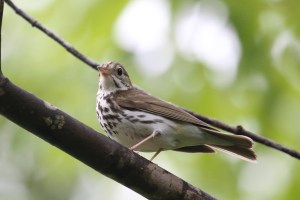
In the deciduous woods at the start, you may catch a glimpse of red-eyed vireos,
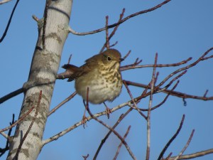
black-capped chickadees, and a hermit thrush or veery, although you are more apt to hear rather than actually see them.
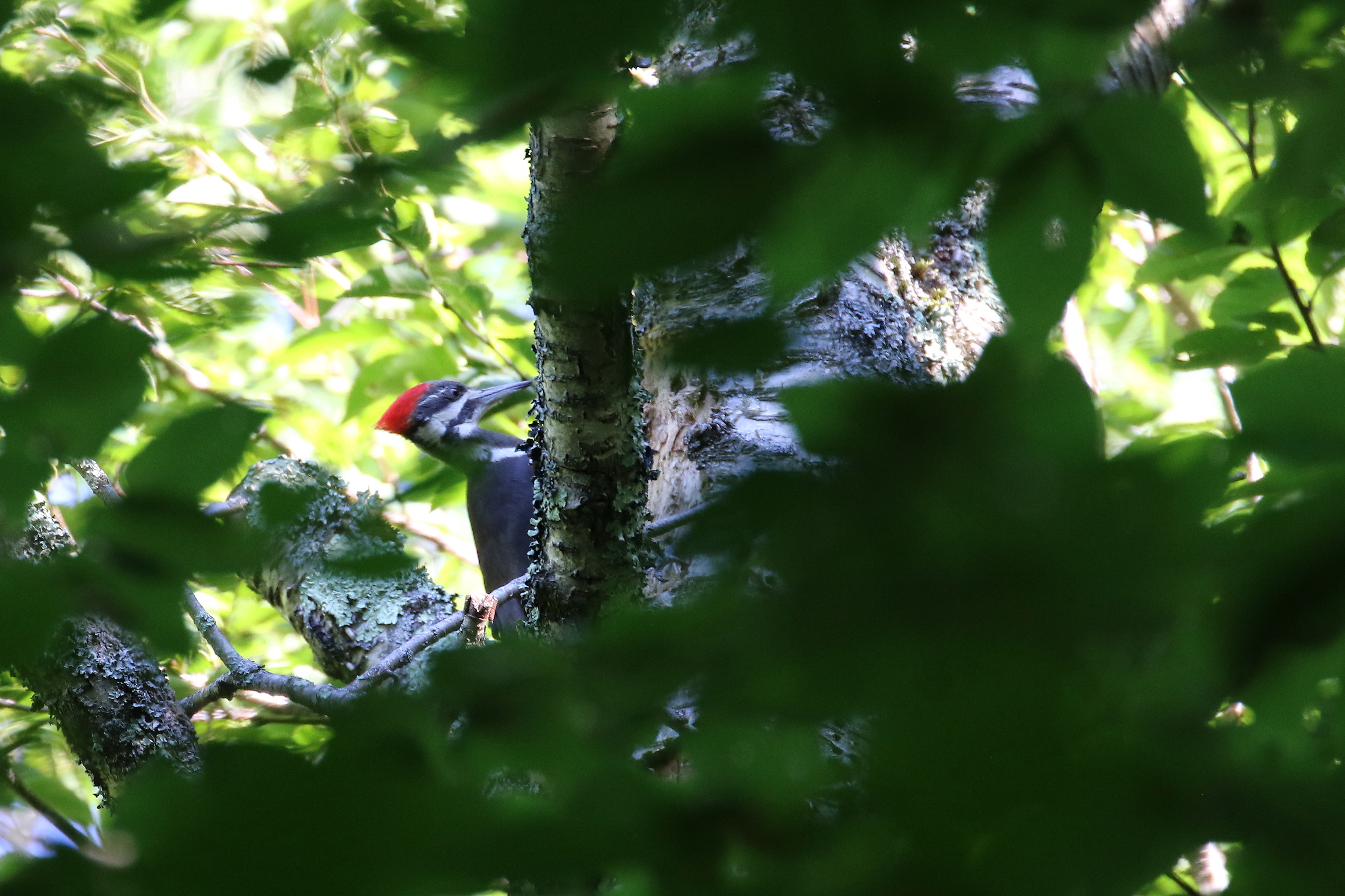
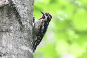
Similarly, a pileated woodpecker might be heard or glimpsed here, as well as further down the trail. Wild turkey wander along or across the trail.
At the beaver ponds, flycatchers are well represented, with very common sightings of
least flycatcher, alder flycatcher, Eastern phoebe, and somewhat less common occurrences of Eastern kingbird. In migration, you may also see olive-sided flycatchers. You can almost always see cedar waxwings that often behave like flycatchers. It’s not unusual to see flocks of 10 to 20 waxwings any time from spring well into fall. A belted
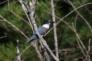
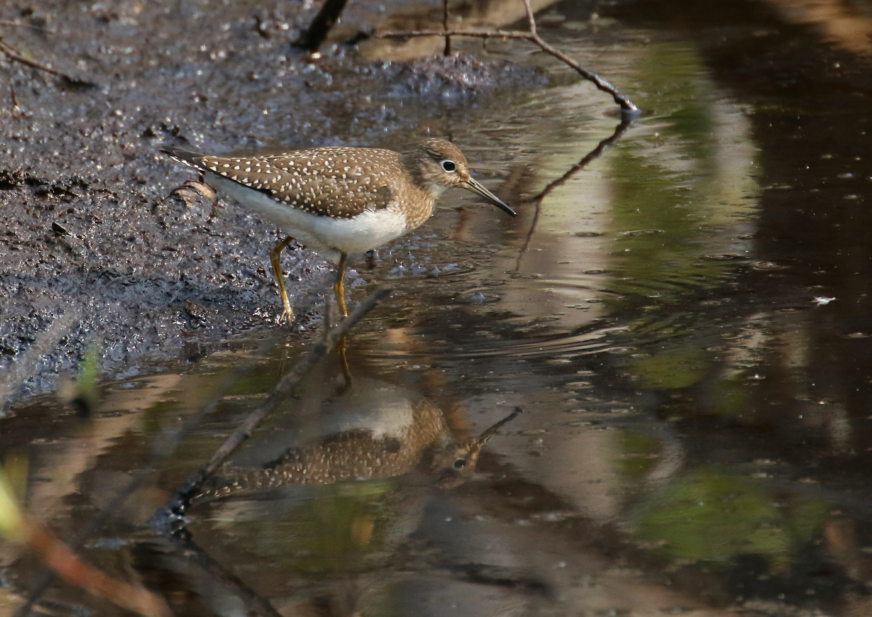
kingfisher or two can usually be spotted checking for prey in the ponds. A very frequent presence is a pair of solitary sandpipers; occasionally other wading birds may be observed. An American bittern shows up here but if you see a bittern, it is usually flying away from you, as they are quite shy birds.
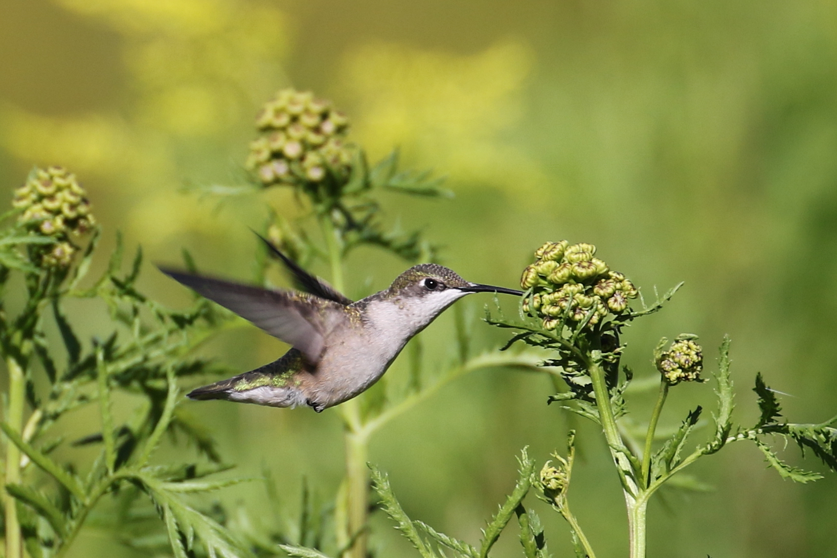
Ruby-throated hummingbirds visit the flowers alongside the trail.
Overhead you will undoubtedly see and hear American crows and blue jays fly by or perch. Very commonly broad-winged hawks can be observed.
Cooper’s hawk, American kestrel and merlin are less common. In addition to pileated woodpecker, both hairy and downy woodpeckers are common, as well as yellow-bellied sapsucker and Northern flicker. The number and variety of ducks is usually not large, depending somewhat on the water level in the beaver ponds, but it is not unusual to see hooded merganser, wood duck, and mallard.
Song birds are varied and change a lot with the season, although some clearly nest here. You can expect to see goldfinch and sparrows, most commonly song sparrow, swamp sparrow, and white-throated sparrow. Warbler observations are quite seasonal but nesting species include common yellowthroat, yellow-rumped warbler, and ovenbird.
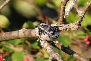
Others less commonly observed include palm, chestnut-sided, black-and-white, blackburnian, and magnolia warblers. The latter warblers are most often found where the alders and conifers begin toward the end of the marshes, along with black-capped chickadee and red-breasted nuthatch. Red-eyed vireos are always around during the summer, and, during migration, blue-headed vireos and an occasional yellow-throated vireo. Rusty blackbird, Eastern bluebird, and American pipit are fun species to spot here, again usually in migration.
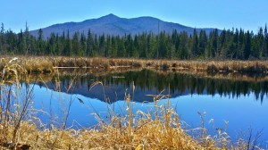
Cherry Pond
Cherry Pond is the largest body of water in the Pondicherry Wildlife Refuge. A viewing platform for the pond is accessible by a very short side trail off Presidential Rail Trail.
- Cherry Pond viewing platform
The entire wildlife refuge should be considered a hotspot for birding with quite a few different habitats to visit. In addition to Cherry Pond, but not directly along the Presidential Rail Trail, are Little Cherry Pond and Mud Pond. Cherry Pond is large enough that common loons frequently visit and nest there. Great blue herons have nested as well. Many waterfowl can be seen: common goldeneye, white-winged scoter, pied-bill grebe, and wood and ring-billed ducks. At the Big Sit birding event on Columbus Day weekend in October, it’s not unusual to see more than 40 bird species just from the platform at Cherry Pond. Ruffed grouse are commonly encountered on the rail trail near the platform. Many of the bird species that are listed above for the Randolph site are seen here as well. In fact, overall, around 170 species have been seen in the wildlife refuge.
Other Birding Spots on the Rail Trail
Another site somewhat different from either of the major “hotspots” is the Randolph Community Forest extension on the south side of U.S. Route 2 known as the Farrar tract, after the family who farmed the property for many years. This site is about 3.5 miles west of the Appalachia trailhead. What was formerly a farmer’s meadow extends from the rail trail about 100 yards down to Israel’s River. It is still mowed annually to maintain the meadow. Willow flycatchers can be found here, and it is also a good place to see belted kingfishers. Among others, the meadow attracts ruby-throated hummingbirds, and the river, spotted sandpipers. This open area provides good viewing overhead to see hawks and an occasional eagle flying over. Another site on the rail trail worth a look is the Moorhen Marsh wetland area just to the east of Cherry Pond. Here you may see the marsh wren or certainly hear it calling in the early summer.

What We’ve Done in 2016
Usage of the PRT: For those of us who use the PRT frequently, it is clear that the trail is being used mu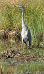 ch more than it had been even a year ago. While walking or cycling, one almost always encounters other users with diverse interests: bikers, walkers, birders, geo-cachers, fishermen, horses and their riders. Often a friendly conversation ensues.
The best way to quantify the increased usage can be seen on our group’s Facebook page (Friends of the Presidential Rail Trail), where a variety of 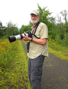 messages and photos are frequently being posted. Our Facebook group has grown to 348 members as of October 2016.
In the media the trail has been listed in Visit NH, “10 Awesome Rail Trails”; the Boston Globe Sunday travel section; and by New Hampshire Grand.
Incorporation: At the PRT Executive Committee meeting in July, we had a long discussion about incorporation and seeking non-profit status. After investigating the process fairly extensively, we determined that it might be more practical to join forces with an existing non-profit. We communicated with the two most logical alternatives: the Randolph Mountain Club and the Coos Cycle Club.
 As the RMC maintains hiker trails rather than multi-use trails like the PRT, the CCCs mission seemed a better fit for FPRT affiliation. This cycling group has recently incorporated, and is working on acquiring non-profit status from the IRS. To have two different cycling groups in Coos County seemed a duplication of substantial effort. The goals of both are to serve cyclists in the same area. Our group, with passionate touring bicyclists cooperating with a motivated group of mountain bikers, would create a stronger and more influential community.
The Board of the CCC, which is facing a very busy slate due to its recent incorporation, responded positively to our overture to join them as a self-standing committee, but asked to postpone any further discussion of affiliation until they have dealt with the current demands their club faces.
Maintenance: When blowdowns have been reported to us, various Friends have either been able to pull them out of the trail or to remove them using a chain saw. We have encouraged people to report blowdowns by using our Facebook page.
Friends have mowed the trail from the Dolly Copp (Pinkham B) Road westward to the Jefferson Notch Road, either by a tractor with a bush-hog attachment, or by a ride-on lawnmower. David Govatski hoped to be able to mow the section from Pondicherry east to 115A.
DRED has been approached to see if we can have access to a key for PRT gates so that a bush-hog could be employed west of the Jefferson Notch Road. They have promised to send us a formal agreement (MOA) to be signed.
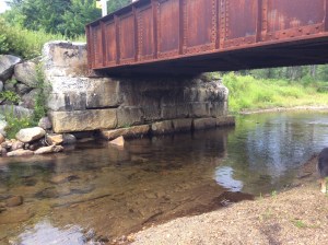 The western abutments of the bridge over Israel’s River west of Bowman are showing deterioration. Photos of the tumbled granite blocks have been sent to John Scarinza of the Randolph Community Forest, who had said he’d send them on to DRED or whomever the appropriate authority is. If a repair could be made soon, we hope the cost could be held to the minimum. However, the eager beavers have subsequently flooded these abutments, and all was under water in early September.
 Signs: 13 signs were successfully installed last spring. They are attractive, distinctive and informative. We were grateful to have had a donation from the organizers of the 2015 Randolph Ramble foot race that paid for the signs and donations of the posts.
In response to a comment from DRED director Chris Gamache that some of our signs were too close to the highway, we’ve investigated the appropriate distance (DOT’s right-of-way extends 33 feet from the highway’s center line, it seems). On consulting DRED’s local supervisor Clint Savage about the positions of the signs, he said several need to be moved further back. This has now been accomplished.
An additional sign should be posted at the snowmobile club junction on the southeast side of the Route US 2 overpass in Gorham, where snowmobilers already have an information kiosk, and several trails cross. DRED has installed a PRT gate to south of this junction, together with signs clearly prohibiting non-snow season ATVs. We will hope to have this new sign in place next spring.
Website: In addition to Facebook, our website friendsofthepresidentialrailtrail.org receives quite a bit of attention. The website has had over 7,300 visits, by a total of more than 2,000 individuals.
Organized Events on the PRT:
 A Walking Tour in early August by FPRT, as advertised in the Berlin Sun and locally in Randolph, drew 12 participants (ranging in age from 12 to 84) on a walking tour eastward from the Dolly Copp Road down the Moose River to Gorham; all gathered for lunch at “Doc Hall’s Pool” on the Moose.
Top Notch Bike Weekend: Despite threatening rain, naturalist Nicky Pizzo conducted a successful tour of the PRT on Saturday, October 22, an event arranged in coordination with the Top of the Notch Inn in Gorham.
FRPT Future Goals:
Affiliation with the Coos Cycling Club.
Working with White Mountain ATV rentals to promote their new fat-bikes.
Erecting an informational kiosk at the parking lot in Gorham.
Continuing (and improving) maintenance of the trail in no-snow months.
Creating a map of the PRT for sale.
A long-term goal is to harden the trail’s surface between NH 115 in Jefferson eastward to Bowman, thus providing a safe route for road bicycles that avoids the narrow, dangerous portion of US Route 2 in Jefferson and Randolph.
Friends of the Presidential Rail Trail
Executive Committee:
Roberta Arbree, Randolph
Nancy de Courcey, Jefferson
Abby Evankow, Gorham
David Govatski, Jefferson
Douglas Grant, Randolph
Al Hudson, Pelham, MA
Judy Hudson, Pelham, MA
James Hunt, Randolph
Jamie Maddock, S Berwick, ME

Sue Maddock, S Berwick, ME
Gary Newfield, Randolph
Ben Phinney, Bozeman, MT
Guy Stever, Randolph
Geocaching along the Presidential Rail Trail
By Nancy De Courcey and Nancy Greenlee
The Presidential Rail Trail is a popular place for geocachers. Since 2008 more than 114 sites have been hidden along the PRT from Jefferson to Gorham—ten more were added just recently! Geocachers from many states and countries have commented on our amazing, wonderful trail—some in languages other than English!
To find a geocache, you will need a GPS-enabled device (hand-held receiver or mobile phone with a GPS app) and a set of coordinates (latitude and longitude) of the cache’s location. There are over two million caches hidden worldwide. The official website, www.geocaching.com, will guide you through the steps of becoming a member (free), choosing a caching name to use when signing logs, and logging your finds. You can read logs for each cache to see how often and when they have been found, and read comments by other cachers. The website offers the ability to search for caches in the area you wish to explore by town, address or other filters.
For the traditional geocache, a geocacher hides a waterproof container with a logbook and then records the cache’s coordinates. The next step is to post these coordinates, along with other details of the location, on the geocaching.com website. Other cachers obtain the coordinates from that listing and look for the cache using their GPS receivers.
Some caches are easy to find and some are devilishly hard. Nancy Greenlee of Jefferson reported last fall that from three different locations on the trail:
“a cache hidden in 2008 has been found by 233 people;
a cache hidden in 2010 has been found by 239 people;
a cache hidden in 2012 has been found by 90 people.”
There was also a cache that had yet to be found.
Caches vary in size, shape, terrain where they are hidden, and how difficult they are to find. After signing the log, the cacher must return the cache to the same location so that other geocachers may find it. Some caches are large enough to contain “swag” or items for trade. Some are tiny. Because they are hidden high and low, it is fun to cache with a partner or group. The more eyes, the better!
Searching geocachers record their “find” in the logbook and then online. Depending on the size of the cache’s container, the cache owner may place items for trading, usually toys or trinkets of little financial value. Should one decide to take an item, geocaching etiquette suggests leaving an item of similar appeal.
In late April 2016, as Nancy De Courcey posted on our Friends Facebook page, “Local geocachers hosted a “CITO” (cache in, trash out) event with sign-in at the Appalachia trailhead parking lot. We collected over fifteen large bags of trailside and roadside trash in 1-1/2 hours. Also a small contingent picked up the Randolph East trailhead area. We had folks from Maine, Vermont, Massachusetts and New Hampshire…People came early and stayed late, enjoying this wonderful resource. One small group was thrilled to share all the animals they had seen and heard on the section near Cherry Pond. It was a first visit to the area for many attendees—they were very impressed with this wonderful resource and plan to return with family and friends to do more exploring and caching on foot as well as on mountain bikes.”
Geocaching is a great family activity, and can be done on foot or on a bicycle. What could be better than a treasure hunt while exploring the scenic Presidential Rail Trail?
SNYDER BROOK PONY TRUSS BRIDGE: A NEW CHAPTER
The repaired Snyder Brook pony truss bridge on the PRT was reinstalled on December 5, 2015. This winter it will be open to the public for snowmobilers, skiers, and walkers, and next spring it will remain open for bicyclists, hikers and pedestrians while c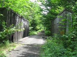 arpenters restore the siding that protects the structure.
The video link here shows the moving of the bridge from its original space.
Pony truss bridges have two distinguishing features: wooden diagonal braces, together with steel tension rods that hold the braces in plumb. This single-span bridge style was used frequently by the Boston & Maine Railroad as a substitute for steel bridges because it was both inexpensive and, before failing under the weight of a train, gave clear signs of deterioration.
Randolph’s pony truss bridge, a “boxed Howe truss,” was built in 1918 by the railroad company, and continued to support freight trains until the Berlin branch was discontinued in 1996. (A similar bridge spanning the Moose River in Gorham was destroyed by arson in 2004. This bridge has been reconstructed, using the original steel parts. The bridge is currently on outdoor display under the auspices of the Gorham Historical Society.)
“The Snyder Brook bridge is significant as… the last surviving wooden railroad track pony truss bridge in the United States that retains integrity of design, location, setting, materials, workmanship, feeling, and association,” writes James Garvin, former NH state historian in the NH Division of Historical Resources inventory.
Although the bridge’s basic structure was still stron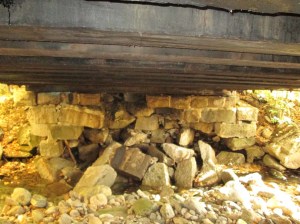 g enough to support recreational activities, by the winter of 2013-14, the abutment on the east side had deteriorated due to
water pressure during the spring run-off. The bridge was then closed to all traffic, and snowmobiles were rerouted. The following summer, it became evident that the bridge might not withstand another winter.
For over a year, the NH Bureau of Trails had been developing a plan of action as well as obtaining funding for the repair through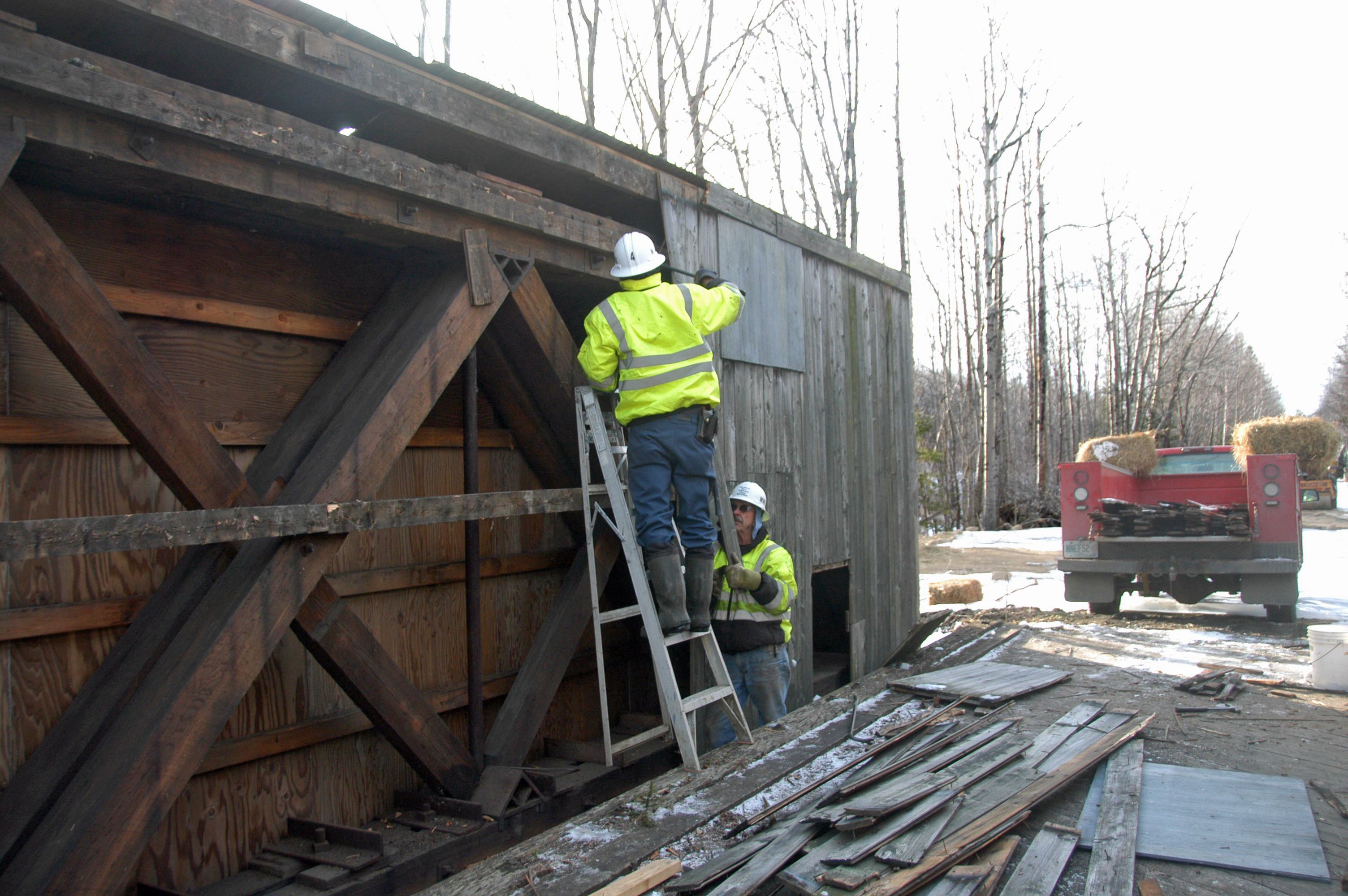 the federal Recreational Trails Program. They were able to authorize and implement an emergency rescue. By early December 2014, they had engaged large-project contractor New England Field Services, LLC, to prepare a dirt platform on the west side of the brook and to remove the interior wood siding so the bridge could be moved.
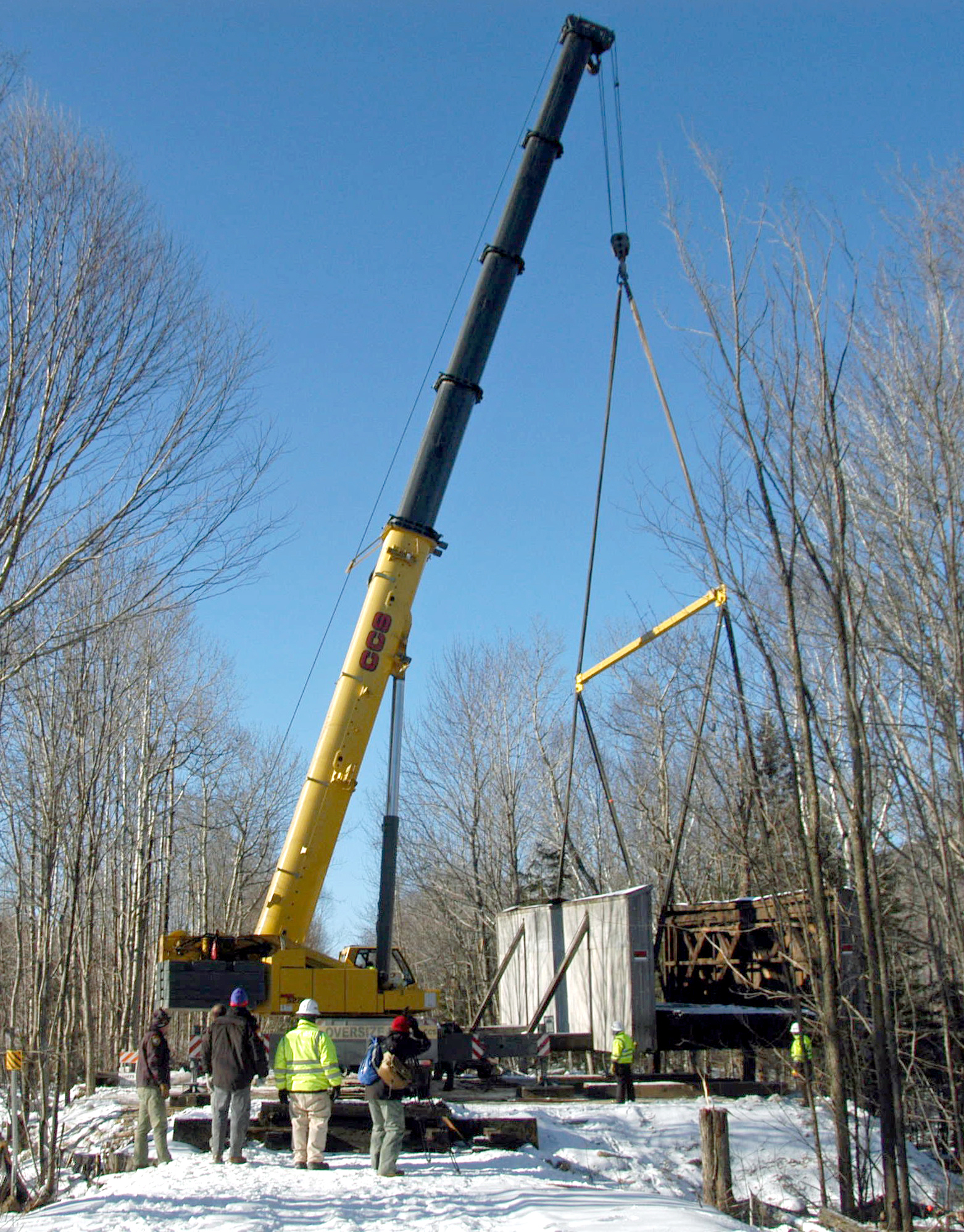
On December 5, 2014, a 275-ton-capacity crane operated by Vermont’s CCS Crane Service lifted the bridge off its abutments and swung it onto the prepared site.
Plans were made to repair the existing structure and the abutments, using the original stones. This process was delayed until fall 2015. Ben Wilson reported, “The West abutment was completely rebuilt with a wing wall using all the original material and 37 yards of concrete backing it up. The brook was also moved back to the middle channel. The carpentry work will be completed in May and until then, the trusses will be covered and protected from the weather.”
 The final steps were taken with the return of the crane, and the successful lifting of the pony truss bridge back into its original position on December 5th. NH Division of Historical Resources Director Ben Wilson is now planning where to provide interpretative information about the Presidential Rail Trail’s historic treasure. A rapid-motion video of the move “back home” is linked to the post below this account.
We would like to express our thanks to many people who have made this possible:
NH’s Department of Resources and Economic Development, especially Trails Bureau Head Chris Gamache and district supervisor Clint Savage;
Ben Wilson, Director of NH’s Bureau of Historic Sites;
Charles Martin author of New Hampshire Rail Trails;
David Govatski, retired USFS forester;
The engineers and employees of Northern New England Field Services, LLC and CCS Crane Service;
Director Phil Bryce of the Division of Parks and Recreation;
Much of the information for this article has come from two sources: former NH historian James Garvin, who completed the bridge’s inventory for the NH Division of Historical Resources; and Edith Tucker, from her articles in the Berlin Reporter and Coos Democrat.
Photo credits to: 1 & 2 by Charles Martin; 3 & 4 by Edith Tucker; 5 & 6 Grant Klene
The Bridge is Back!
Yes, we put the bridge back in place on Monday. The West abutment was completely rebuilt with a wing wall using all the original material and 37 yards of concrete backing it up. The brook was also moved back to the middle channel. The carpentry work will be completed in May and until then, the trusses will be covered and protected from the weather. We will also be applying NO-CHAR to the entire bridge structure to hopefully protect it from arson. Currently the trail is back open and will remain so, even when the carpentry work is being completed.
Ben Wilson
NH DRED
Here is a link to a video of the bridge replacement.
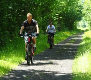
Mellow Mountain Biking from Gorham
Abby Evankow describes a recent loop using the Presidential Rail Trail from Gorham 15 miles, about 3 hours.
One of the appeals of this loop is that you can get on at several different points–from your motel in downtown Gorham, from your campsite at Dolly Copp Campground or Moose Brook State Park, or from the Rail Trail parking lot on Rte 2, just west of Gorham.
We got a late start on our mid-September ride because of a flat tire. Fortunately, Crooker Cycle Sports (240 Glen Ave., Berlin, 603-752-3632) graciously replaced the defective tube so we weren’t held up for long. We parked at the Rail Trail Parking lot and headed west, toward Randolph, on the Presidential Rail Trail. It’s a beautiful bike path with a gentle uphill grade along the Moose River with increasing views of the Presidential Range. Even cycling at mid-day, much of the trail is nicely shaded by the thick forest on each side. After about 2 miles, you’ll cross a bridge and find hidde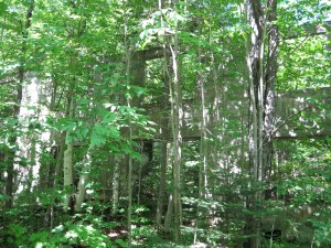 n, just off the trail to the north (right), a big gutted concrete structure. This is what remains of the Mount Madison Spring Company that bottled the spring water at the turn of the century and made various drinks, including Dolly Copp Ginger Ale. (When you’re back in town, visit the Gorham Historical Society, 25 Railroad St.-466-5338.) When you reach the open beaver pond and marsh, you’ll know you’re getting close to the junction with Dolly Copp Rd (also known as Pinkham B Rd). A giant blue heron took flight, not 10 feet from us. This is a great spot for birdwatching.
We left the PRT, turning east (left) on the Dolly Copp, a seasonal road that passes through the White Mountain National Forest and connects Rte 2 and Rte 16. We definitely appreciated the thick shade as the terrain got steeper–no railway grade here, but the 2-mile climb to the height of land is nicely modulated. A few cars passed us, but we mostly had the alternately rough asphalt/packed-dirt road to ourselves. Just over one mile up, on the right, is the Town Line Brook Trail, an easy 0.2 mile walk to scenic Triple Falls. It’s a steep, narrow gorge with plenty of lush moss, quite scenic despite the low flow. We appreciated the break and got back on our bikes to finish our climb. At the height of land, you’ll see the trail head and parking lot for the Pine Link Trail up Mt. Madison. Coasting down was lovely, but once we realized there were potholes of various sizes, camouflaged by the shadows, we slowed our descent.
About a mile down on our left, we passed the gated entrance to a snowmobile route–the Bear Springs Trail, a more rugged path with ups and downs, some uneven terrain as well as a few muddy patches. Being novice mountain bikers, we stayed on Dolly Copp Rd to Rte 16, roughly another mile. Here, we turned north (left) and cruised easily on a wide, smooth shoulder downhill all the way back to Gorham. While we missed the peace and quiet of the woods, we got to admire a handsome BIG moose, eating brush along the roadside. Once in town, we stopped at the White Mountain Cafe (212 Main St. Gorham 603-466-2511), one of our favorite places for a caffeinated beverage, lunch and cookie. To finish our ride, we turned left onto Bellevue Place at the sign for the Gorham airport, and flowed this quiet, dead-end street to a big locked gate that conveniently has a well-worn path for bikes and walkers to get around. The packed dirt road took us back to where we had started, at the PRT parking lot on Rte 2.
Including the stops at Mineral Springs bottling plant, short hike to Triple Falls, and wild-life photography, we made the approximately 15 mile trip in less than 3 hours.
Bike-Walk Alliance Conference
Members of the FPRT are planning to attend an all-day conference on bicycle and pedestrian transportation that the Bike-Walk Alliance of New Hampshire is sponsoring. The event will be held in Concord at the NH Department of Environmental Services on Wednesday, September 30, 8:30 am to 4 pm. A panel discussion on Rail Trails is scheduled from 10:30 am to noon.
To help publicize the PRT, the Friends have created the poster reproduced here.

Attendance is free. For more information and to register, click on link below;
Tales and Trails Excursion
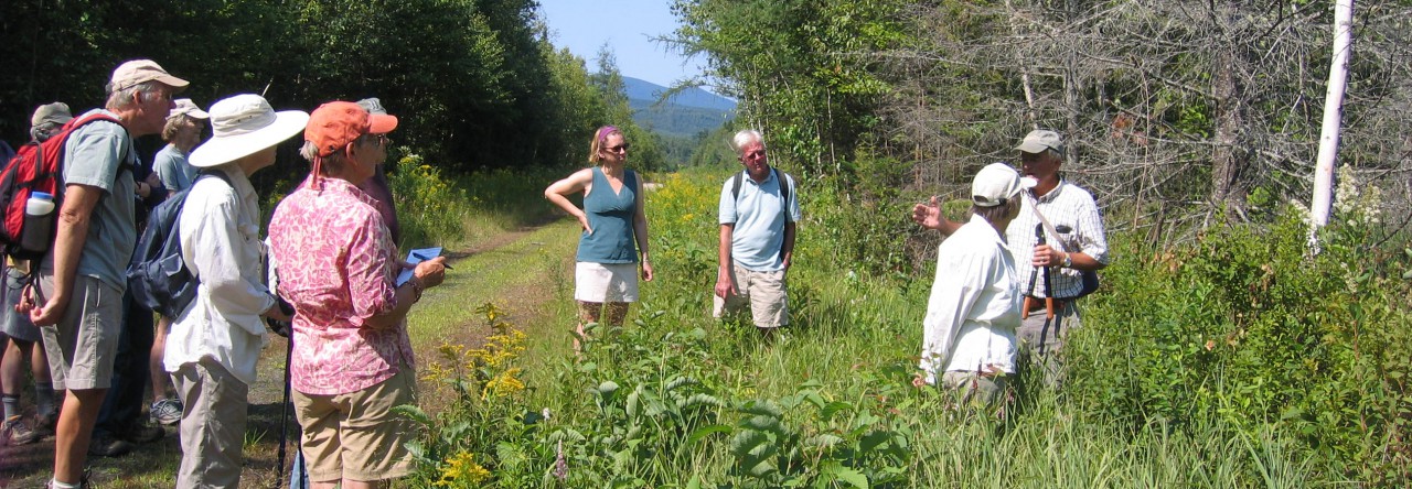
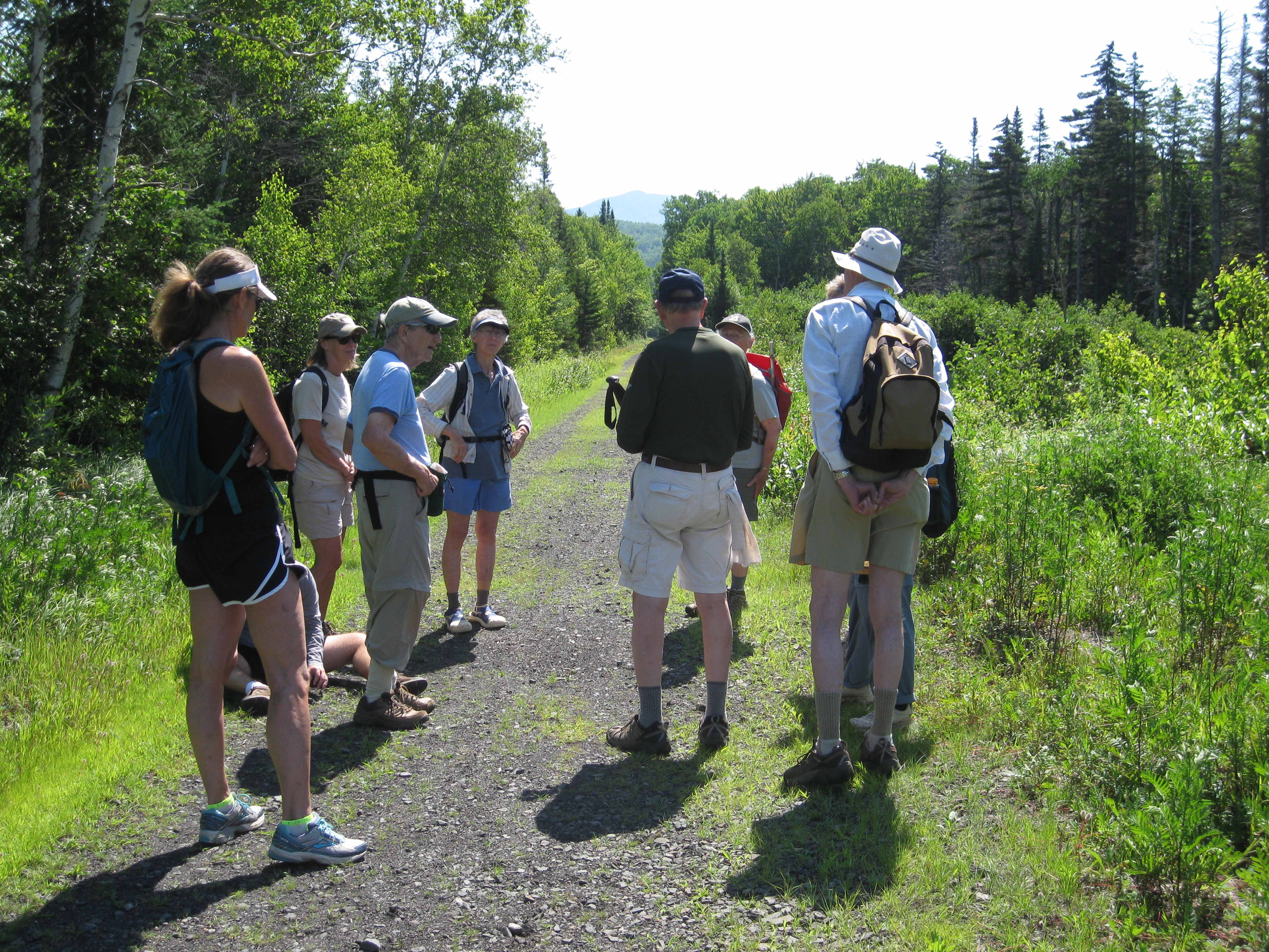 A group of walkers and cyclers joined the Randolph Mountain Club’s “Tales and Trails” excursion in mid-July on the Presidential Rail Trail between the Pinkham-B Road and Mineral Springs.
Continue reading “Tales and Trails Excursion”
